Footpaths and Rights of Way
Young or old, high-powered competitor or infrequent half-marathon runner, you will very likely on occasions get out into the countryside (such as we have) and benefit from the experience.
If you have taken a responsibility as run leader, or just naturally lead a group at times, it is useful to know not only how to get from A to B but also what your rights of access are.
Some of you, hopefully, may even take a more critical interest and involvement in helping to maintain or extend our access rights. If no-one does, we stand to lose them.
This link (https://www.rotherham.gov.uk/rights-way/public-rights-of-way/1) will take you to the Rotherham MBC Public Rights of Way website.
Follow the link to get the map.
The interactive map is a superb facility. It is easy to use and absorbingly interesting even for non-runners.

You will be operating on the RMBC website, not RHAC. We thank RMBC for this public access.
The best way forward is to launch straight in. At first the map seems not much use:
like many other maps you can click it larger, or drag it around.
You can continue to click it so as to show individual houses!
Note the menu bars in top left, click open the “Map Features” menu (done below with a part of Wickersley showing) and the items you want. .
The different types of right of way can be selected (I find it easier to select all of them.)
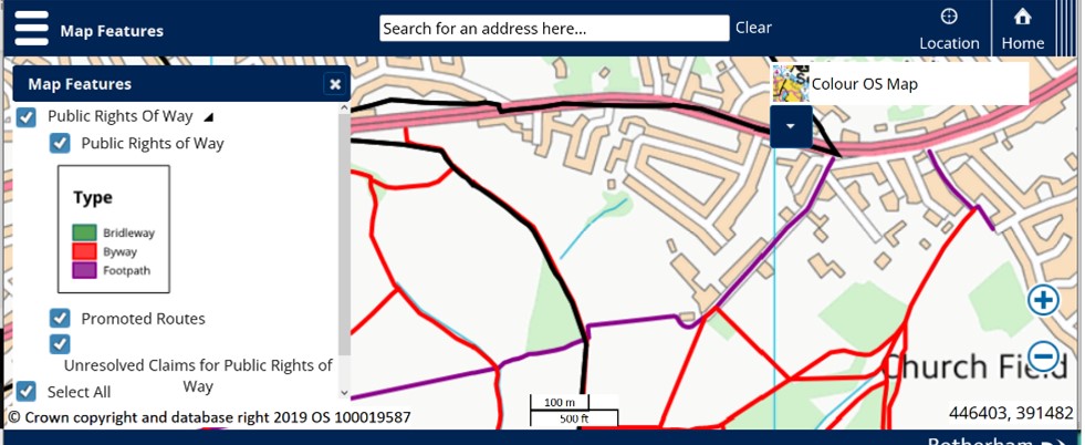
This not an exact definition, but more or less: Purple: shows footpaths- people on foot, no bikes or horses Green: bridleways- horses permitted, also cycling I think (but may or may not be permitted locally) Red: byways- open to traffic
‘Promoted routes’ are such as ‘doorstep walks’ in local areas.
The other lines you will see are boundary lines.
You can work your own way through now, but just a few points might help:
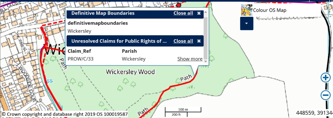
** You might get some surprises along the way. What we thought were rights of way frequently appear to be ‘unresolved claims’
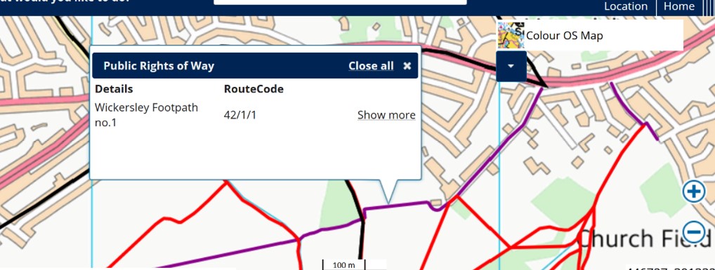
In the map above I clicked on a footpath trace (Airmount Close down towards the golf club). A pop-up appeared to define what you are looking at- Wickersley Footpath #1
If you click a black line, the pop-up will define the parish on each side. Public rights of way seem to be very parochial! It seems that the paths in Wickersley Wood are unresolved claims !
The Claim_Ref referred to in these map pop-ups are in a list of claims which you can freely download. One page for reference is at the end of this display.
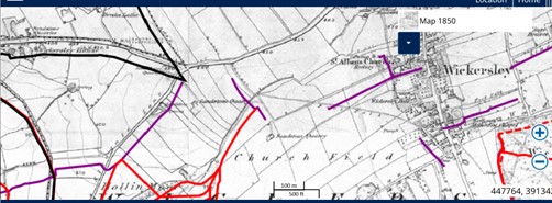
You might have noticed the buttons in top right of your map. They are also interesting: they give you the same layout of paths and boundaries, but superimpose them on historic maps rather than current OS.Apart from being interesting, that may guide as to how.why/whether the tracks are genuinely rights of way…..